FS2020: Bush Trips
Bush Trips in Microsoft Flight Simulator (2020) are a set of activities which consist of multiple pre-planned stops along a pre-planned route, though the pilot may deviate at their leisure. They serve as a form of guided sightseeing. As of World Update XI: Canada (WU11) (2022-09-28), there are 32 official Bush Trips in the simulator.
Mechanics
Each bush trip has one aircraft assigned which must be flown for the entirety of the trip. Upon beginning the first leg, the player will load into the world in that aircraft on the apron and with the engine already started and the fuel tank full. The leg of a bush trip is completed by successfully landing at the next airport in the route and bringing the aircraft to a full stop anywhere on the airfield, to include the runway, taxiways, service apron, and any parking areas. Skipping a landing and proceeding to the next airport will not complete the leg.
VFR Map
The VFR Map is an in-sim mini-map which is populated with nearby topography, airports, and an approximate suggested route. Following the indicated route is not required for successful completion. As the user can reach completion by landing on any of the available runways at the destination airport, the route does not account for turns to reach landing patterns or after immediately takeoff. A slider on the VFR Map allows topographic elevation lines to be toggled on or off. Elevation changes and all standing bodies of water are drawn exactly to their outlines on the surface and can be reliably used for visual navigation. Larger rivers are also drawn on the map, though smaller rivers and all roadways are omitted. The route may be flown at any altitude, though it is generally easier to recognize landmarks when piloting at an altitude of 1,000 to 2,000 feet Above Ground Level (AGL).
| “ | Assistance on the trip will be available in the form of a help button on the VFR Map – however, be advised that using this will disable achievements tied to this activity. | ” |
The navigation panel (default key: N) will be populated with multiple Points of Interest (POI), each with a heading and Estimated Time En-route (ETE) to that POI. The ETE is pre-calculated using the cruise speed of the assigned aircraft and a straight-line path. The ETE does not account changes in speed due to climbing, descending, nor reduced engine performance at higher altitudes.
All POIs are accompanied by a text written description of the navigational landmarks and remarkable sights on the way to that POI.
Fuel Consumption and Refueling
The fuel level of the aircraft is recorded upon a successful landing and carries over to the next leg of the bush trip. As of World Update IV: France/Benelux (WU4) (2021-04-13), using the refuel hotkey (default key: Ctrl + F) at an airport with fuel services will call a fuel truck and one will arrive, but will not offload any fuel. The only workaround is to bind Refuel & Repair to a hotkey and use that instead.
Damage and Failure Conditions
Like fuel, minor damage carries over between legs of the trip, though does not carry through the whole trip due to the refueling workaround repairing all damage. Major damage such as a crash into a building or landing in a body of water which would normally cause a black screen failure will also fail that leg of the bush trip and require restarting the failed leg.
5 of the 14 bush trips are flown in a traditional gear aircraft ("tail draggers", i.e. the CubCrafters XCub and the Zlin Savage Cub). Pilots should exercise caution when stopping in these aircraft as they are prone to "nose over": too heavy braking can cause the aircraft to tip forward, which may result in the propeller striking the ground. This kind of crash instantly fails the leg.
List of Bush Trips
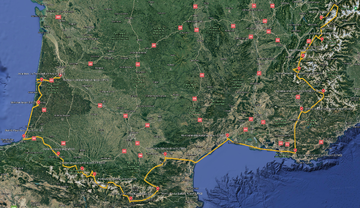
Bordeaux to Mont Blanc
| “ | A breathtaking journey to reach the highest peaks in Western Europe. From the heart of French wine country, set out onto sandy coastlines and pristine pastoral landscapes; behold cliff-side castles and awe-inspiring valley; all on your way to explore the snow-dusted ranges of the Pyrenees mountains and the unforgettable splendor of Mont Blanc and the Alps. For this trip you will be piloting the Diamond DA40 NG, a solid 168 hp turbodiesel that delivers remarkably fuel-efficient performance, superb handling and impressive vertical speed. |
” |
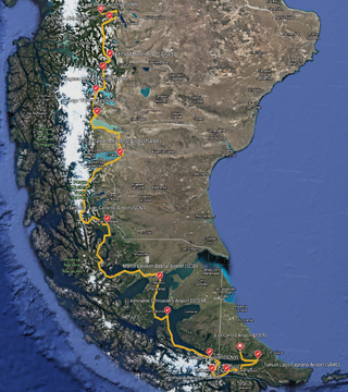
Los Cerros to Cochrane
| “ | A spectacular journey through the Patagonian region of South America, from the Land of Fire to Glacier Alley. Navigate a labyrinth of islands, channels, forest and fjords, age-old ice fields and crystal-blue lakes. It's an area rich with spellbinding scenery, all of it waiting for you to explore. You'll be flying a CubCrafters XCub. With remarkable short take-off and landing performance, an average cruise speed of 129 knots (233 km/h) and extended range, this is the ultimate aircraft for an adventure in the Andes Mountains. | ” |
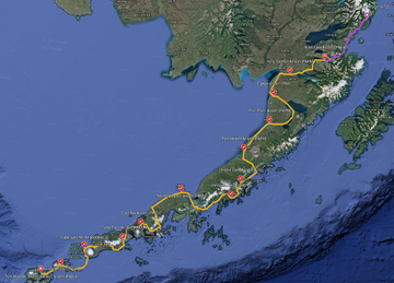
Unalaska to Kulik Lake
| “ | A stunning tour through the Bush territories of the Alaska Peninsula. From the far reaches of the Aleutian Islands, weave through mountain ranges and volcanic peaks, follow glacial rivers and pools, and find your way up the icy coastline of the state known as 'The Last Frontier.' You'll be in the cockpit of the CubCrafters XCub, an adventure aircraft with a cruising speed of 117 knots (217 km/h) and remarkable STOL capabilities to attack the backcountry. |
” |
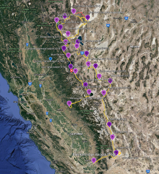
Breckenridge to Mariposa-Yosemite
| “ | From abandoned goldfields on California's western foothills to the cracked desert plains of Black Rock City, from the glistening shores of Lake Tahoe to the sprawling cliffs of Yosemite Valley, this epic journey into the majestic Sierra Nevada has no shortage of breathtaking scenery to discover, from a perspective few pilots ever get to experience. You'll be flying a Zlin Savage Cub. With a cruising speed of 90 knots (166 km/h), this is the perfect plane for exploring the stunning sights and natural wonders of North America's west coast. |
” |
Rijeka to Santorini
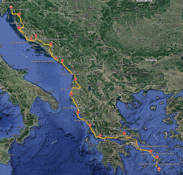
| “ | A journey to discover the vast, open beauty of the Balkans, a sprawling multinational region rich with old world charm and even older world mythology. Explore glittering coastlines and evergreen forests, rugged hinterlands and rolling hills, sand-strewn beaches and crystal blue seas. This is the unparralleled splendor of Southeast Europe, on full display for you to behold. You'll be flying a Cessna 172 Skyhawk. With a cruising speed of 124 knots (229 km/h), it is the ideal bush plane for sightseeing around the world. |
” |
Discover Denmark
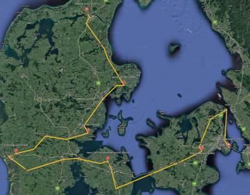
| “ | This sight-packed tour will have you fly throughout the most striking landmarks of Denmark, one of the most historically rich countries in the world. You'll be treated to centuries-old castles, enchanting natural features including lakes and forests, and stunning works of architecture and art. You'll experience the journey from the cockpit of a Cessna 172 SP featuring Garmin G1000 avionics, a premier touring aircraft that is a true joy to navigate from one incredible sight to the next. Assistance on the trip will be available in the form of a 'Back of Track' button on the VFR Map — however, be advised that using this will disable achievements tied to the activity. |
” |
Discover Finland
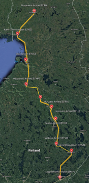
| “ | This captivating journey will immerse you in the beauty and intrigue of Finland as you fly deep into its interior and make your way north all the way to the Arctic Circle. During this flight, you'll lay your eyes on an explore a diverse multitude of sights, including small towns, gorgeous vistas of forests, lakes, and rivers, and feats of modern design. You'll be in the cockpit of a CubCrafters XCub, the ideal airplane for this adventure as you'll want to fly low and slow to take close looks at all of the incredible sights. Assistance on this trip will be available in the form of a 'Back of Track' button on the VFR Map — however, be advised that using this will disable achievements tied to the activity. |
” |
Discover Iceland
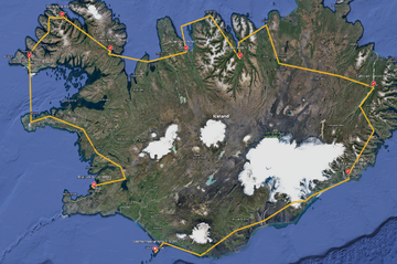
| “ | This wondrous journey will have you circle the stunning island of Iceland, skirting its rugged coastline and exploring the beautiful offerings of this renowned destination born of volcanic fire. You'll lay your eyes on towering mountains, intricate glaciers, and vertical sea cliffs, among a host of other spectacles. You'll enjoy this tour from inside the cockpit of a Cessna Grand Caravan EX, an ideal aircraft for this trip as it allows broad views of the many gorgeous vistas you'll encounter. Assistance on this trip will be available in the form of a 'Back of Track' button on the VFR Map — however, be advised that using this will disable achievements tied to the activity. |
” |
Discover Norway
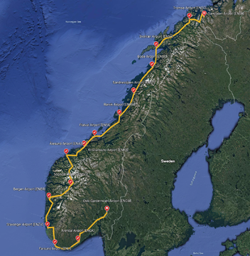
| “ | In this magnificant flight tour of Norway, you'll feast your eyes on an incredible range of inspiring, exhilarating sights. You'll fly past massive sheer-walled fjords, ranges of glacially-carved peaks, and some of the world's greatest feats of architecture, both modern and centuries-old. You'll experience these thrilling sights in a sporty Beechcraft Bonanza G36, an ideally suited aircraft for this unforgettable Nordic adventure. Assistance on this trip will be available in the form of a 'Back of Track' button on the VFR Map — however, be advised that using this will disable achievements tied to the activity. |
” |
Discover Sweden
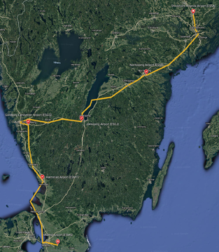
| “ | This enthralling flight will traverse the beautiful southern portion of Sweden, beginning just north of Stockholm and ending at the southern extremity of the country. You'll be treated to a tremendous array of stunning sights, including gorgeous coastlines, broad sweeps of lush forest, and exquisite architecture. You'll embark on this tour in a Diamond DA40 NG Diamond Star, an aircraft ideally suited for this exploration of Sweden due to its balance of speed, maneuverability, and cockpit views. Assistance on this trip will be available in the form of a 'Back of Track' button on the VFR Map — however, be advised that using this will disable achievements tied to the activity. |
” |
Germany Journey
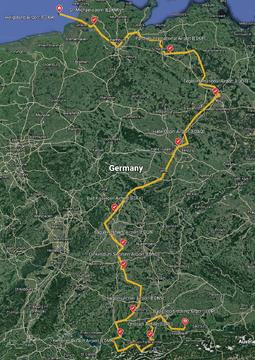
| “ | This flight begins in the far north of Germany, in the Heligoland archipelago in the North Sea, and then heads south, visiting the beauty of Muritz National Park and sights of Berlin. From there, the journey brings you to the beauty and varied intrigue of sights along the famed Romantic Road of Bavaria, then traverses the highest swath of Germany along the country's southern extremity. You'll fly this route in a sleek, sporty Beechcraft Bonanza G36, an aircraft perfectly suited for this rich, dynamic journey. Assistance on the trip will be available in the form of a 'Back on Track' button on the VFM Map — however, be advised that using this will disable achievements tied to this activity. |
” |
Austria Tyrol High Mountains
| “ | Travelling from east to west, you'll visit Austria's renowned cities and towns, its great mountains, and its gorgeous lakes and rivers. Points of interest include the capital Vienna, the nation's highest mountain, Grossglockner, and a number of sights off-the-beaten-patch, notable in the famed Tyrol. You'll embark on this tour in a Cessna 208 Grand Caravan, stopping off at airports large and small throughout the country on this unforgettable and inspirational aerial voyage. Assistance on the trip will be available in the form of a 'Back of Track' button — however, be advised that using this will disable achievements tied to the activity. |
” |
Grand Alpine Challenge
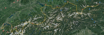
| “ | This aerial journey is one that delivers both challenges and incredible rewards. You'll visit some of the most breaktaking parts of the Alps, one of the world's most renowned mountain ranges. Flying a CubCrafters XCub, you'll need to skillfully navigate the skies above extreme terrain to lay eyes on the peaks, glaciers, lakes, rivers, enclaves, and more of this fabulous tour that traverses four countries: Switzerland, Liechtenstein, Austria, and Germany. Assistance on the trip will be available in the form of a 'Back of Track' button — however, be advised that using this will disable achievements tied to the activity. |
” |
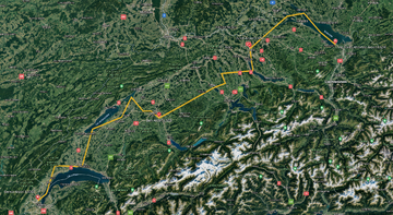
Swiss Northern Lakes
| “ | The invigorating flight, which connects the lakes of northern Switzerland, will take you to some of the most beautiful scenes in all of Europe. This route stitches together immersive vistas of nature, the man-made, and unique fusions of the two. You'll explore these signs in a Cessna 172 G1000, ideal for this journey due to the wide field of view its cockpit offers and its solid performance in navigating the skies. Assistance on the trip will be available in the form of a 'Back of Track' button — however, be advised that using this will disable achievements tied to the activity. |
” |
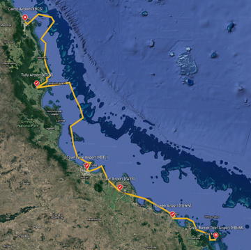
North Queensland Coast
| “ | Australia's north Queensland coast is one of the planet's most alluring destinations. Home to the renowned Great Barrier Reef, the largest coral reef in the world, the area is defined by long stretches of white sand beach, turquoise waters, and lush tropical vegetation. Exploring this part of AUstralia from the air brings unforgettable, mesmerizing views. Long, elegant arcs of sand disappear into the distance, seeming to merge with sea and sky. Evocative forms, both on and beneath the sea's surface, spring forth with each passing view. The ever changing mood of the sky, with clouds billowing and casting shadows beneath them, always adds a flair of drama. Assistance on the trip will be available in the form of a 'Back of Track' button — however, be advised that using this will disable achievements tied to the activity. |
” |
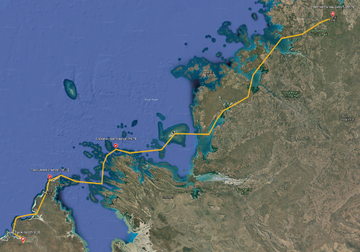
Northwestern Kimberly Coast
| “ | Northwestern Australia's Kimberley Coast is a realm of incredible pristine beauty seen by few. Here ,the harsh desert meets the waters of the Indian Ocean along a shoreline of cliffs, vast numbers of islands, and beaches that disappear into the distance. In this bush trip, you'll be treated to aerial views of the very best of this region. Beginning at Beagle Bay Airport, the journey winds along landscapes and seascapes of the coast, allowing intimate views of natural detail as well as broad, grand vistas of sea, land, and sky. The flight ends on the Mitchell Plateau, a feature surrounded by low mountains and hills that is one of the least populated areas not just in Australia, but on the planet. Assistance on the trip will be available in the form of a 'Back of Track' button — however, be advised that using this will disable achievements tied to the activity. |
” |
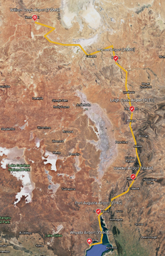
From the Sea Into the Desert
| “ | Australia is renowned for its diversity of environments, from ultra-modern urban, to rolling mountains, to dense tropical rainforests, and much more. One of the great ways to experience this variety is to travel from one realm into another, exploring each and the transition between them. One of the best of the journeys lies in the state of South Australia, along a corridor that runs from the Indian Ocean, north across stretches of savannah, and into the Tirari Desert. This journey begins at the northern extremity of the Spencer Gulf, part of the Indian Ocean's Great Australian Bight, visiting coastline, cities and towns, and ends in the harsh and mysterious desert in the area of Lake Eyre. The lowest point in Australia at roughly 50 feet below sea level, Lake Eyre is spectacular from the air, revealing its myriad elegant largescale facets that are best appreciated from above. Assistance on the trip will be available in the form of a 'Back of Track' button — however, be advised that using this will disable achievements tied to the activity. |
” |
Australia Southeastern
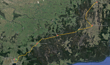
| “ | The southeastern corner of Australia offers a broad multitude of sights from the air, including exquisite architecture, long stretches of coastline, and the country's highest mountains. Lifting off from Canberra, Australia's capital city, you'll explore the best that this planned urban area has to offer before setting off to the hills and peaks of the Australian Alps. Explore vast stretches of rolling terrain woven into valleys, broad plains, and plateaus until you reach Mount Kosciuszko. The country's high point at 7,310 feet above sea level, Kosciuszko is surrounded by lakes and reservoirs, each with its own unique character. After passing over the crowning heights of Australia, you'll explore the urban center of Melbourne, including some of the most spectacular skyscrapers in the country. The journey comes to an end after visiting Port Melbourne on the northern extremity of Port Phillip Bay. Assistance on the trip will be available in the form of a 'Back of Track' button — however, be advised that using this will disable achievements tied to the activity. |
” |
Tasmanian Odyssey
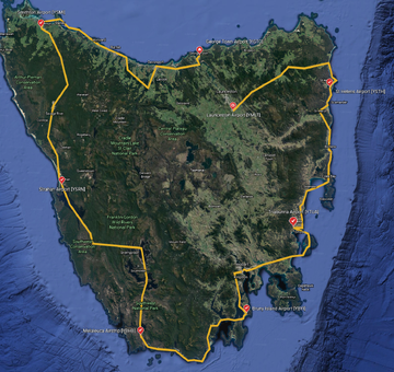
| “ | Tasmania is a land of intrigue and enchanting beauty. The smallest, least populous, and southernmost of Australia's states, Tasmania offers a wide range of locations to explore. These include white sand beaches, sea cliffs, lush forests, winding rivers, imposing mountains, and a range of architecture. This journey brings the very best of Tasmania to life for the aviator. it begins at the northern end of the island, exploring the rugged coastline, verdant stands of trees, and islands found there. The route traverses a series of natural corridors in a counterclockwise circumnavigation route around the island. It visits the southernmost reaches of Tasmania, the capital, Hobart, and then explores such renowned locations as the Bay of Fires, the Gardens, and Coles Bay in the northeast before drawing to a close. Assistance on the trip will be available in the form of a 'Back of Track' button — however, be advised that using this will disable achievements tied to the activity. |
” |
Portugal Journey
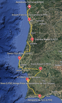
| “ | This north-south aerial adventure takes you along Portugal’s stunning Atlantic coastline. Beginning at the tiny Aeródromo de Cerval, located in the countryside just inland of the sea at the far northern end of Portugal, you’ll fly the coastline all the way to the country’s southern extremity. You’ll explore all that this part of the Iberian Peninsula offers, including modern cities, tiny hamlets, and a full range of natural creations. Assistance on the trip will be available in the form of a 'Back on Track' button on the VFR Map -- however, be advised that using this will disable achievements tied to the activity. |
” |
Pyrenees Excursion
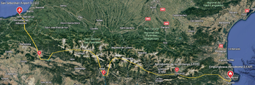
| “ | This bush trip, which spans the full width of the Iberian Peninsula, explores the storied Pyrenees mountains. The journey begins on the coast of the Mediterranean Sea, at the Gulf of Roses, then traverses the entire range of peaks from southeast to northwest, and ends at the waters of the Bay of Biscay. From the cockpit, you’ll admire all the best that this spine of peaks displays, including the ridges, valleys, and summits of the Pyrenees themselves, to the small villages, fields, and forests that complete this wonderful Iberian mosaic. Assistance on the trip will be available in the form of a 'Back on Track' button on the VFR Map -- however, be advised that using this will disable achievements tied to the activity. |
” |
Mediterranean Coast
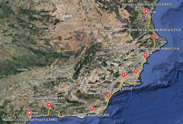
| “ | Beginning at Spain’s Málaga Airport and ending at the country's famed city of Valencia, the Mediterranean Coast aerial journey visits some of the most fantastic coastal views to be found anywhere on the planet. The carefully designed flight highlights some of the most intriguing and stunning locations on Spain's famed Mediterranean coastline, with legs beginning and ending at a broad array of airport types, offering challenges in addition to incredible vistas. Assistance on the trip will be available in the form of a 'Back on Track' button on the VFR Map -- however, be advised that using this will disable achievements tied to the activity. |
” |
Iberia Connection
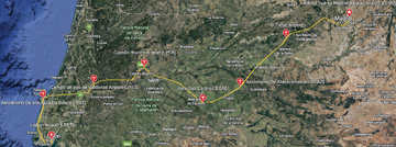
| “ | Beginning just outside of Madrid, Spain, the Iberian Connection flight takes you west, through Portugal, to the Atlantic coast, ending at Lisbon, Portugal's capital and largest city. This incredible journey highlights some of the best that this part of the world has to offer. You'll experience mountain views, pastoral vistas, intriguing architecture, and rugged coastline. Assistance on the trip will be available in the form of a 'Back on Track' button on the VFR Map -- however, be advised that using this will disable achievements tied to the activity. |
” |
The Apennines
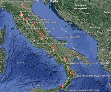
| “ | The Apennines, also called the Apennine Range, is a chain of mountains that forms the spine of the Italian Peninsula (also called the Apennine Peninsula). At just over 900 miles in length, they are anchored in the north at their juncture with the southern Alps, and they extend to the 'tip of the boot' at the southern extremity of the peninsula. The range is composed of terrain that ranges from rolling lowlands to sheer cliffs and knife-edge ridgelines. The highest point of the Apennines is Corno Grande, which lies in the central portion of the range 27 miles inland of the Adriatic Sea. Rising to 9,554 feet above sea level, Corno Grande is home to one of Europe’s southernmost glaciers, the tiny Calderone. The Apennines bush trip begins in the northern end of the range at Bologna Guglielmo Marconi Airport (LIPE), just northwest of the city of Bologna. From there, the route weaves its way southward along the backbone of the Italian Peninsula, visiting cities, villages, lakes, forests, and parks, passing by some of the great peaks of the range. The journey comes to a close by traversing the shoreline of the Tyrrhenian Sea in the southernmost reaches of the peninsula, then ends at Reggio Calabria Airport (LICR), just outside of the city of Reggio Calabria, on the shore of the Strait of Messina. Assistance on the trip will be available in the form of a 'Back on Track' button on the VFR Map -- however, be advised that using this will disable achievements tied to the activity. |
” |
Sardinia Tour
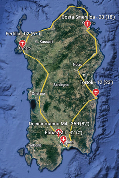
| “ | The island of Sardinia is an autonomous region of Italy located to the south and west of the Italian peninsula. The second largest island in the Mediterranean, Sardinia, with the island of Corsica, to its north, forms the western boundary of the Tyrrhenian Sea. Although part of Italy, Sardinia is actually slightly closer to the African continental landmass than it is to that of Europe, with its southern extremity just 115 miles north of Tunisia. Sardinia is renowned for its variety of natural environments, which includes coastlines, forests, plains, and mountains, many of which are relatively pristine. Approximately 1.6 million people live in Sardinia, the two largest cities being Cagliari, the capital of the region, and Sassari. For many decades, agriculture and sheep farming formed the core of Sardinia’s economy. Today, while the island is home to roughly 4 million sheep, the dominant industries include tourism, finance, and information technology. The Sardinia Tour provides an exceptional window into the whole of the island, with a route that both transects its interior and follows its dramatic coastline. The tour begins just to the northwest of Cagliari at Decimomannu Air Base (LIED). From there, it heads northwest, to begin a clockwise circumnavigation of Sardinia. The itinerary includes sections along coasts on the west, north, east, and south, many of which feature sheer cliffs rising directly out of the water. The flight passes over the island’s highlands in the east, home to Sardinia’s highest point, Punta La Marmora, and vast swaths of forest. The journey also includes cities large and small, and tiny, remote villages. It comes to an end at Cagliari Elmas Airport (LIEE) after visiting Cagliari. Assistance on the trip will be available in the form of a 'Back on Track' button on the VFR Map -- however, be advised that using this will disable achievements tied to the activity. |
” |
Sicily Journey
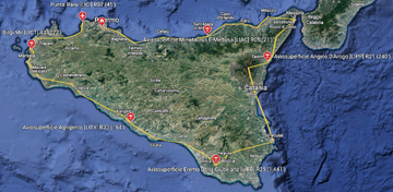
| “ | Sicily is a mountainous, triangular-shaped island located just off the southwestern coast of the Italian Peninsula. One of the country’s 20 national regions (and one of five considered autonomous), it is separated from the mainland by the narrow Strait of Messina and is the largest island in the Mediterranean Sea. Steeped in history that dates back thousands of years to the Ice Age, Sicily is inhabited by roughly 5 million people today. The region maintains a heritage of rich agricultural bounty, the foundation of its economy due to its favorable climate combined with its fertile, volcanic soil. Olives, grapes, and wine are its most notable products. The Sicily Journey explores the best of this region from the air. It begins at Palermo-Boccadifalco Airport (LICP), just to the west of Palermo, Sicily’s capital and largest city, and heads east, starting a clockwise circumnavigation of the island. Some of the highlights of the flight include the port city of Messina, which lies on the Strait of Messina, just a little more than four miles from mainland Italy, Mount Etna, the highest mountain in Italy outside of the Alps and one of the largest volcanoes in Europe, and Agrigento, a hilltop city on the southern coast. The Sicily Journey concludes with a landing just inland of the Tyrrhenian Sea at Falcone Borsellino Airport (LICJ). Assistance on the trip will be available in the form of a 'Back on Track' button on the VFR Map -- however, be advised that using this will disable achievements tied to the activity. |
” |
Appalachian Summits
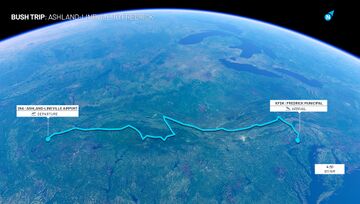
| “ | One of the most renowned, and far-reaching, regions of the United States, the Appalachian Mountains are notable for the individual forms within the chain of peaks and also for the history that they helped to forge. One of the oldest mountain systems in the United States at 480 million years in age, the Appalachians are physically subdued compared to younger American ranges like the Sierra Nevada and the Rockies, but they are nevertheless awe-inspiring, and in some cases imposing, and even evocative. Appalachian Summits explores this chain of peaks through an itinerary anchored by the high points of a number of Appalachian States. Beginning in the southern reaches of the mountain range, this journey visits Alabama's Cheaha Mountain, Georgia's Brasstown Bald, Tennessee's Clingmans Dome, North Carolina's Mount Mitchell (the highest point in the Appalachians), Virginia's Mount Rogers, Kentucky's Black Mountain, West Virginia's Spruce Knob, Maryland's Hoye-Crest, and Pennsylvania's Mount Davis. The flight also visits areas around these high points, landmarks both well-known and also less travelled. |
” |
California Dreams
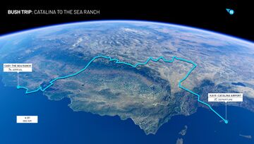
| “ | The state of California is one of the most geographically diverse places in the world. It hosts a tremendous range of sights from urban, to coastal, to desert, to mountain, and much more. The state contains both the highest point in the conterminous United States (Mount Whitney) and the lowest point in the country (Badwater Basin). It is home to grand monuments of infrastructure and architecture like the Golden Gate Bridge of San Francisco and the U.S. Bank Tower of Los Angeles. It is also a realm steeped in history, notably of those inspired to dream big and create masterpieces of technology and art of all types and to strike off and explore the peaks, shorelines, and other reaches of the state. California Dreams celebrates this part of the United States through an aerial itinerary that weaves through the most spectacular, the most renowned, and the most historic that this state has to offer. Beginning at Santa Catalina Island, one of southern California’s Channel Islands, the flight visits Los Angeles, the Mojave Desert, Death Valley, the High Sierra, the Great Central Valley, and San Francisco before coming to an end on the northern California coast. |
” |
Northeast Megalopolis
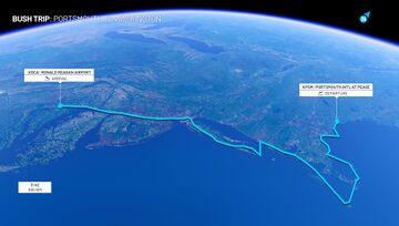
| “ | The Northeast Megalopolis, with more than 50 million residents, is the most populous metropolitan region in the United States. Also called the “Boston-Washington Corridor” or just “BosWash,” this megaregion is composed of Boston, New York City, Philadelphia, Baltimore, and Washington, D.C., some of the most renowned, and influential, cities not just in the United States, but in all of history. This journey visits the most iconic and beautiful of this region. It ties together the famous with the less travelled, the grand with the subdued, granting an experience that mirrors the diversity of the cities and surroundings. Beginning in Portsmouth, New Hampshire, the flight heads south, visiting Boston, coastal destinations including Cape Cod and Long Island, New York City, Philadelphia, Baltimore, and Washington, D.C., exploring these storied places and their surroundings. |
” |
Vancouver Island
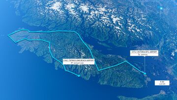
| “ | Vancouver Island, hailed as one of Canada’s most geographically diverse and beautiful regions, is located in southwestern British Columbia, part of the greater Pacific Rim. The island borders the Pacific Ocean on its western periphery and it is separated from mainland North America by a series of straits on its northeast, east, and south. The island, 283 miles long by 100 miles at its widest, comprises an incredibly varied spectrum of landscapes, including coastal fjords, mountains, dense forests, and urban patchworks. Home to British Columbia’s capital, Victoria, Vancouver Island has Canada’s most temperate climate due to the Pacific’s influence, with many areas rarely experiencing freezing temperatures. This bush trip explores all that Vancouver Island has to offer, taking in its coasts, high mountains, small towns, and the city vistas of Victoria. Beginning at Tofino-Long Beach Airport, located on the island’s central western coastline, the route heads north, visiting lakes, rivers, small towns, coastal forms, and mountains along the way. The journey then heads down the eastern margin of Vancouver Island, flying along the Strait of Georgia, and then ends at Victoria. |
” |
Newfoundland Passage
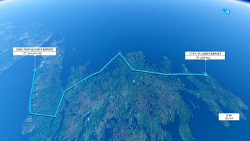
| “ | Newfoundland, located in eastern Canada and part of the province of Newfoundland and Labrador, is a sparsely populated island of austere beauty. At just over 42,000 square miles in area, it is the fourth largest of Canada’s islands, and the largest of its islands outside of those of its high arctic (Baffin, Victoria, and Ellesmere). Populated by less than a half million and experiencing a subarctic climate where North Atlantic storms lash it, relatively few travel to Newfoundland. Those who do venture to the area are treated to spectacular vistas of coastline, interior mountains, lakes, rivers, sweeps of tundra, and the colorful, historically-evocative architecture of its few settlements. This bush trip visits all of the best that Newfoundland has to offer, beginning at the small Port au Choix Airport, located on the island’s northwest. The journey then weaves a course throughout a medley of the island’s geography to the Avalon Peninsula, ending at Newfoundland’s most populous city, St. John, the capital of Newfoundland and Labrador. |
” |
Canadian Rockies
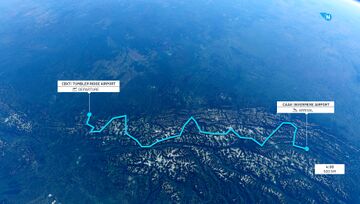
| “ | The Canadian Rockies, which straddle the Alberta-British Columbia border, are renowned as one of the world’s most distinctive and striking mountain chains. Part of the greater North American Cordillera, a system of ranges that spans from Mexico to Alaska, the mountains of the Canadian Rockies feature numerous glaciers, sheer cliff faces, high mountain lakes, and peaks that rise to 12,972 feet above sea level. These mountains attract alpinists, photographers, trekkers, and mountain lovers from throughout the globe to bask in their natural magnificence. Venturing to the Canadian Rockies is a humbling experience, whether scaling their heights, hiking beneath any of the range’s looming massifs—or flying amid their airy summits. This bush trip explores the heart of the Canadian Rockies, including those of Jasper National Park, Glacier National Park, and the chain’s crown, Mount Robson. Beginning at British Columbia’s Tumbler Ridge Airport, which lies amid rolling forest to the east of the crest of the range, the journey heads into the heart of this alpine wonderland. The route continues south along the spine of the range, soaring amid knife-edge ridges, flying past hanging glaciers, and exploring some of Canada’s most rarified ground before coming to an end at Cranbrook\/Canadian Rockies International Airport. |
” |
Community Content
- Bush trip repository at Flightsim.to (300+ free downloadables)
External links
- Bush trip guides by: fanbyte • SegmentNext
History
- Added Germany Journey - Duene to Jolling - Beechcraft Bonanza G36
- Added Austria Tyrol High Mountains - Schwechat to Dornbirn - Cessna 208 B Grand Caravan
- Added Grand Alpine Challenge - La Cote to Aigen im Ennstal - CubCrafters XCub
- Added Swiss Northern Lakes - Geneva to Altenrhein - Cessna 172 Skyhawk
World Update V: Nordics Europe (WU5) (2021-06-17):
- Added Discover Denmark - Copenhagen to Aalborg - Cessna 172 Skyhawk
- Added Discover Finland - Lappeenranta to Rovaniemi - CubCrafters XCub
- Added Discover Iceland - Vestmannaeyjar to Reykjavík - Cessna 208 B Grand Caravan EX
- Added Discover Norway - Oslo to Sørkjosen - Beechcraft Bonanza G36
- Added Discover Sweden - Stockholm to Malmö - Diamond DA40 NG
World Update IV: France/Benelux (WU4) (2021-04-13):
- Added: Bush Trips/Bordeaux to Mont Blanc - France - Diamond DA40 NG
World Update III: United Kingdom (WU3) (2021-02-16):
- Fixed a specific crash while using little VFR Map in bush trip activities
World Update II: USA (WU2) (2020-11-24):
- Added Bush Trips/Unalaska to Kulik Lake - Alaska - CubCrafters XCub [Undocumented change]
- The bush trip menu should no longer freeze
World Update I: Japan (WU1) (2020-09-29):
- Back on track feature should no longer show the wrong airport
Patch 1.8.3.0 (2020-09-16):
- Fix leg completion trigger.
- Completionist achievement should now unlock when all activities have been completed.
Closed beta (2020-07-28): Bush trip system added to the sim. Available bush trips:
- Added Breckenridge to Mariposa-Yosemite - Nevada - Zlin Savage Cub
- Added Los Cerros to Cochrane - Patagonia - CubCrafters XCub
- Added Rijeka to Santorini - Balkans - Cessna 172 Skyhawk (G1000)

