FS2020: Unalaska to Kulik Lake
Jump to navigation
Jump to search
Unalaska to Kulik Lake is a Bush Trip in Microsoft Flight Simulator (2020). This bush trip is flown in the CubCrafters XCub. The trip consists of 12 legs over a distance of 741 nm with an estimate cruise time of 6 hours and 4 minutes.
| “ | A stunning tour through the Bush territories of the Alaska Peninsula. From the far reaches of the Aleutian Islands, weave through mountain ranges and volcanic peaks, follow glacial rivers and pools, and find your way up the icy coastline of the state known as 'The Last Frontier.' You'll be in the cockpit of the CubCrafters XCub, an adventure aircraft with a cruising speed of 117 knots (217 km/h) and remarkable STOL capabilities to attack the backcountry. |
” |
Route
| Leg | Airport City Coordinates |
Location ID | Distance (NM) |
Flight Time (hh:mm) |
Use Type | Fuel (100LL) |
|---|---|---|---|---|---|---|
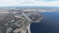
| 0 | Tom Madsen (Dutch Harbor) Airport Unalaska, AK 58°44'44.15"N 156°14'13.25"W |
IATA: DUT ICAO: PADU FAA LID: DUT |
originating airport | public | yes | |
| 1 | Akutan Airport Akutan, AK 54°8'40.85"N 165°36'14.96"W |
IATA: KQA ICAO: PAUT FAA LID:7AK |
40.71 | 00:19 | public | no? |
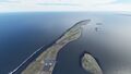
| 2 | Cape Sarichef Airport Unimak Island, AK 54°50'52.96"N 163°24'25.80"W |
IATA: WSF ICAO: PACS FAA LID: 26AK |
57.24 | 00:27 | closed | no |
| 3 | False Pass Airport False Pass, AK 54°50'52.96"N 163°24'25.80"W |
IATA: KFP ICAO: PAKF FAA LID: KFP |
70.04 | 00:33 | public | no |
| 4 | Cold Bay Airport Cold Bay, AK 55°12'25.35"N 162°43'38.26"W |
IATA: CDB ICAO: PACD FAA LID: CDB |
38.46 | 00:18 | public | yes |
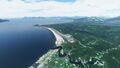
| 5 | Nelson Lagoon Airport Nelson Lagoon, AK 56°0'26.92"N 161°9'33.87"W |
IATA: NLG ICAO: PAOU FAA LID: OUL |
111.95 | 00:53 | public | no? |
| 6 | Perryville Airport Perryville, AK 55°54'27.44"N 159°9'33.87"W |
IATA: KPV ICAO: PAPE FAA LID: PEV |
90.77 | 00:43 | public | no? |
| 7 | Chignik Lake Airport Chignik Lake, AK 56°15'20.17"N 158°46'41.79"W |
IATA: KCQ FAA LID: A79 |
29.54 | 00:14 | public | no? |
| 8 | Port Heiden Airport Port Heiden, AK 56°57'36.29"N 158°38'54.05"W |
IATA: PTH ICAO: PAPH FAA LID: PTH |
63.05 | 00:29 | public | no? |
| 9 | Pilot Point Airport Pilot Point, AK 57°34'49.04"N 157°34'12.19"W |
IATA: PIP ICAO: PAPN FAA LID: PNP |
51.88 | 00:24 | public | no? |
| 10 | Egegik Airport Egegik, AK 58°11'4.67"N 157°22'29.51"W |
IATA: EGX ICAO: PAII FAA LID: EII |
77.42 | 00:36 | public | no? |
| 11 | King Salmon Airport King Salmon, AK 58°40'34.80"N 156°38'55.03"W |
IATA: AKN ICAO: PAKN FAA LID: AKN |
50.52 | 00:24 | public | yes |
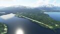
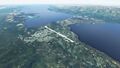
| 12 | Kulik Lake Airport Kulik Lake, AK 58°57'55.91"N 155°5'55.46"W |
IATA: LKK ICAO: PAKL FAA LID: LKK |
59.56 | 00:28 | public | no |
| 13 | Chinitna Bay Airport Chinitna Bay, AK 59°49'59.28"N 153°5'11.13"W |
FAA LID: A72 | ? | ? | public | no |
Trivia
- The
Alaska.PLNfile in the simulator install includes a 13th leg which is commented out but, if un-commented, allows for the bush trip to extend nearly an hour to the Northeast to Chinitna Bay Airport and requires a beachhead landing.
History
World Update II: USA (WU2) (2020-11-24):
- Added Bush Trips/Unalaska to Kulik Lake - Alaska - CubCrafters XCub [Undocumented change]
External links
- Interactive route map by user Thadius856 using Google Earth (web)
- AUS Flight Simmer Lets Play Alaska Bush Trip on YouTube
Airport previews
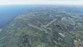
00 - PADU
01 - PAUT
02 - PACS
03 - PAKF
04 - PACD
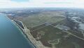
05 - PAOU
06 - PAPE
07 - A79
08 - PAPH
09 - PAPN
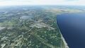
10 - PAII
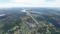
11 - PAKN
12 - PAKL


