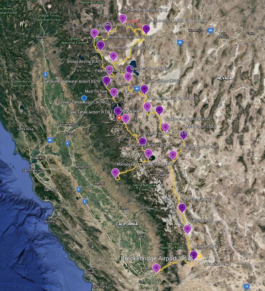
File:FS2020-Bush Trip-Breckenridge to Mariposa-Yosemite-Map.png
Jump to navigation
Jump to search


Size of this preview: 546 × 599 pixels. Other resolutions: 219 × 240 pixels | 1,124 × 1,233 pixels.
Original file (1,124 × 1,233 pixels, file size: 3.91 MB, MIME type: image/png)
Summary
Screenshotted using Google Earth. Google Earth flight plan by official forum user DSkyDawg
Licensing
This work is copyrighted. It will be used in a way that qualifies as fair use under US copyright law.
File history
Click on a date/time to view the file as it appeared at that time.
| Date/Time | Thumbnail | Dimensions | User | Comment | |
|---|---|---|---|---|---|
| current | 18:36, 22 February 2023 | | 1,124 × 1,233 (3.91 MB) | Thadius856 (talk | contribs) | == Summary == Screenshotted using Google Earth. [https://earth.google.com/earth/rpc/cc/drive?state=%7B%22ids%22%3A%5B%221Uip9719SX1StRJAYwf47wyQLrA8fWNzf%22%5D%2C%22action%22%3A%22open%22%2C%22userId%22%3A%22105744274277587293970%22%7D&usp=sharing Google Earth flight plan] by official forum user [https://forums.flightsimulator.com/u/DSkyDawg DSkyDawg] |
You cannot overwrite this file.
File usage
The following 3 pages use this file: